Lake Burragorang arguably has the strictest access rules to a catchment area anywhere in the world.
The two main rivers which feed Lake Burragorang are the Coxs River which flows past the Lithgow coal mines and town as well as the Wollondilly River from Goulburn. Both flow past urban areas and through agricultural land. Both are readily accessible to the public not far upstream from the Lake.
The Tonalli River is a short local waterway which carries sediment from the old silver mining areas into the Lake with significant quantities of lead arsenic, zinc, copper cadmium and silver. Here is some research on the Tonalli River pollution which enters Lake Burragorang.
Considerable quantities of urban and agricultural pollutants as well as treated sewerage wash into Lake Burragorang via the Coxs and Wollondilly Rivers but there has been a fairly unchallenged orthodoxy since the 1960s that Lake Burragorang needs to be protected by a heavily enforced public exclusion zone.
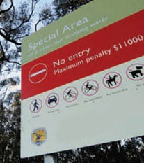
You can view the restricted areas with this interactive map.
In their 2011 study Kristiana, Vilhena, Begg, Antenucci & Imberger reported on the pollution which currently enters the dam from the catchment area:
“The outer catchment area is mostly cleared of native vegetation and has agricultural and urban uses (Citation Armstrong and Mackenzie 2002). The total human population in the catchment was estimated at 105,000 in 2005, with townships of 6000–20,000 people; sheep and cattle grazing were the dominant agricultural land use (Citation Ryan et al. 2005). The population in the catchment is served by 9 sewage treatment plants, mostly located close to the Coxs arm of the reservoir, so most of the treated sewage enters the reservoir via Coxs River (Citation Ferris and Tyler 1985, Citation Ryan et al. 2005).”
We believe it is time for a sensible debate with specialist professional involvement as to the future of the Burragorang Catchment area for recreational activities. The following examples are of catchment areas which allow recreation activities and our aim is for this to be a starting point to the conversation. We currently do not hold any position on what recreation should or should not be allowed. We do not have the technical expertise to make that call. This page is simply to encourage a robust discussion.
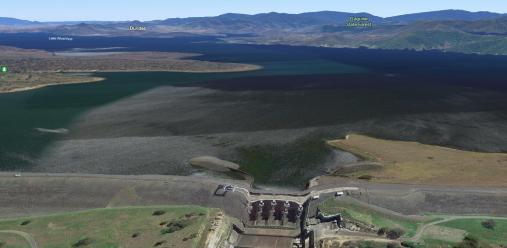
Lake Wivenhoe – Water Supply to Brisbane and Ipswich, Queensland.
Lake Wivenhoe provides more than half of South Eastern Queensland’s drinking water.
SEQWater allows these recreational activities:
- BBQs and picnics
- playgrounds
- camping (at private campgrounds)
- multi-use trails – walking, running, mountain biking and horse riding
- swimming, scuba diving and snorkelling (in the designated swimming areas)
- canoeing, kayaking and rowing
- sailing
- fishing (permit required)
- motorised boats (restrictions on engine type and speed limit apply)
Click here for more information on recreational activities at Wivenhoe Dam.
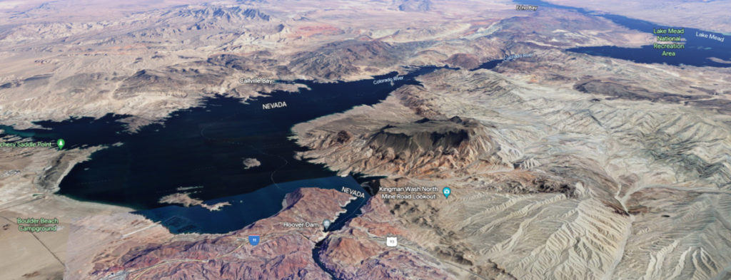
Hoover Dam. Lake Mead – Water supply to Las Vegas, Nevada, Pheonix and Tucson, Arizona.
This catchment and lake provide water to around 25 million people.
US National Parks Service allows:
- fishing
- swimming, scuba diving and snorkelling
- boating and water skiing,
- canoeing, kayaking and sailing.
- hiking
- horse riding
More information HERE.
The Australia Water Association has an interesting web page about how recreation and water quality management can coexist. See https://www.awa.asn.au/