The Yerranderie airstrip is part owned by Wollondilly Council and part by National Parks.
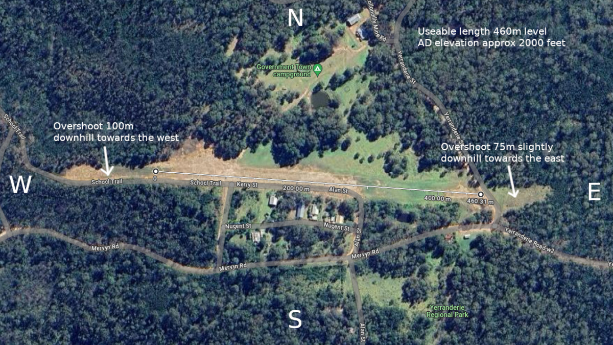
The Yerranderie Airstrip runs roughly east west (magnetic) and is in the Melbourne Centre 124.1 communication area. It does not have an allocated CTAF frequency. The C LL is at 8,500′. The step down to 7,500′ and the Sydney 124.55 region is only a few miles to the east. Here is the Google Maps link showing the location.
If you would like further information you can contact Rob Thompson on 0429 493 828 who has permission to use the Wollondilly Council owned section of the airstrip.
Take a run along the runway in this video….
Here’s some drone footage taken over the airstrip….