Richard Shaw has done an incredible job of mapping the Yerranderie mines. His video below is a virtual “fly around” of the mine workings which flies you over the top and underground to demonstrate the layout of the mine shafts and workings. Best to view it in a slightly darkened place.
Below are the plan and elevation images lined up which gives a great perspective as to how extensive the mines where when mining ceased in 1927.
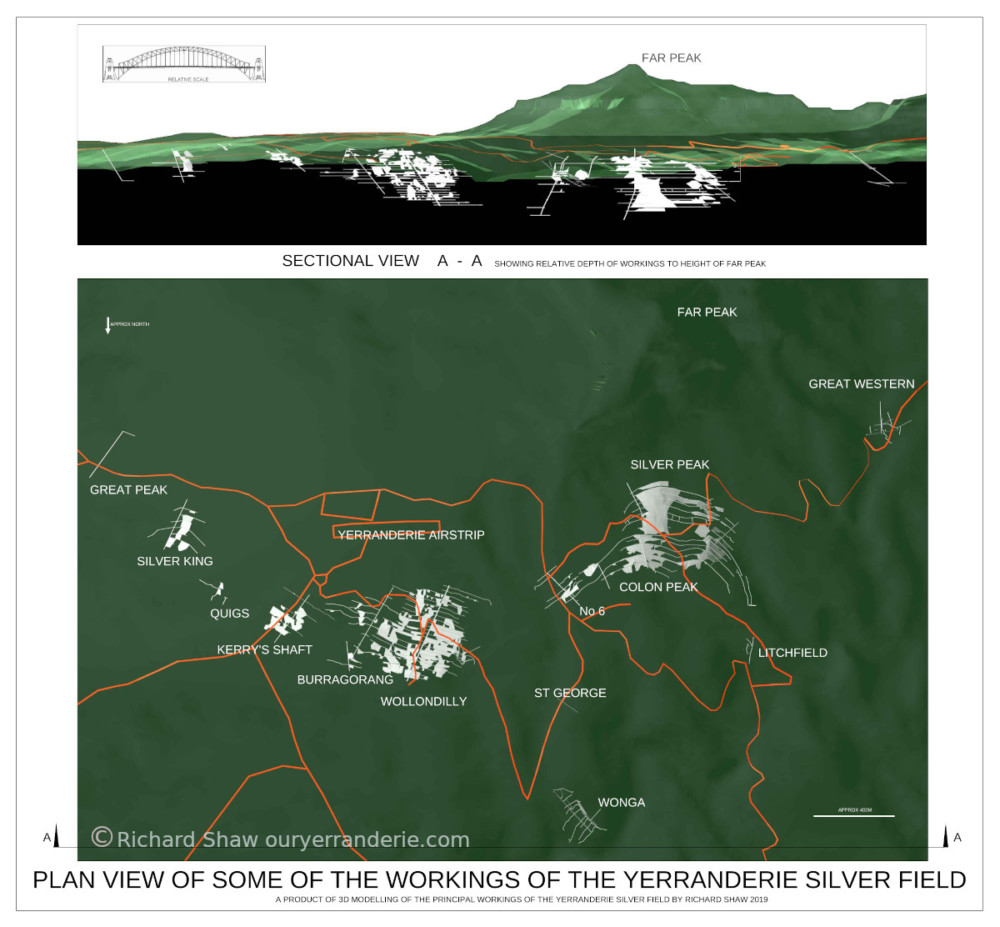
An Explanation from Richard Shaw:
This project came about after my first trip to Yerranderie which was purely to have a look around a place that I had heard the name of, but didn’t know anything about.
After undertaking the walk shown on the NPWS handout and observing the enormous mullock heaps, it was immediately obvious that there must have been an equally enormous amount of underground mining activity.
My specific research on the Yerranderie Field has since resulted in the creation of a 3D computer model of the major workings by combining historical information from mining records and plans which of course consist of only 2D information. The 3D fly arounds include the terrain and prominent features such as Far Peak together with the main tracks/roads and airstrip at Yerranderie and can be used to visualize the relative scale of the workings.
The inclusion of the image of the Sydney Harbour Bridge in the stand-alone graphics also gives an easily identifiable object by which to compare relative sizes.
My graphics and fly-arounds of the Yerranderie Silver Field pretty much are a follow on from my Hill End Project which had its origins from me sitting on my horse at Merlins lookout, viewing the western slopes of Hawkins Hill, observing the amount of mullock there and pondering the extent of the underground works. That project has since resulted in the production of 3D computer graphics and virtual fly arounds of areas which include workings within the world famous Golden Quarter Mile.