At this time the only unrestricted road access to Yerranderie is via the Oberon Colong Stock Route. The three roads we are discussing on this page have locked gates and restrictions.
You must have permission to use these routes! There are significant penalties if you are caught in a restricted area.
1- Sheehy’s Creek Road then the W4 Trail,
Prior to 2019, Sydney Water escorted monthly travel for 4WD convoys from Oakdale to Yerranderie along Sheehys Creek Road, crossing the Bailey Bridge (over the Nattai River) then following the W4 trail to the Murphys Crossing of the Wollondilly River. These trips were mainly for residents and traversed about 25 kilometres of Schedule 1 Restricted land which is the 3 kilometre exclusion zone around Lake Burragorang.
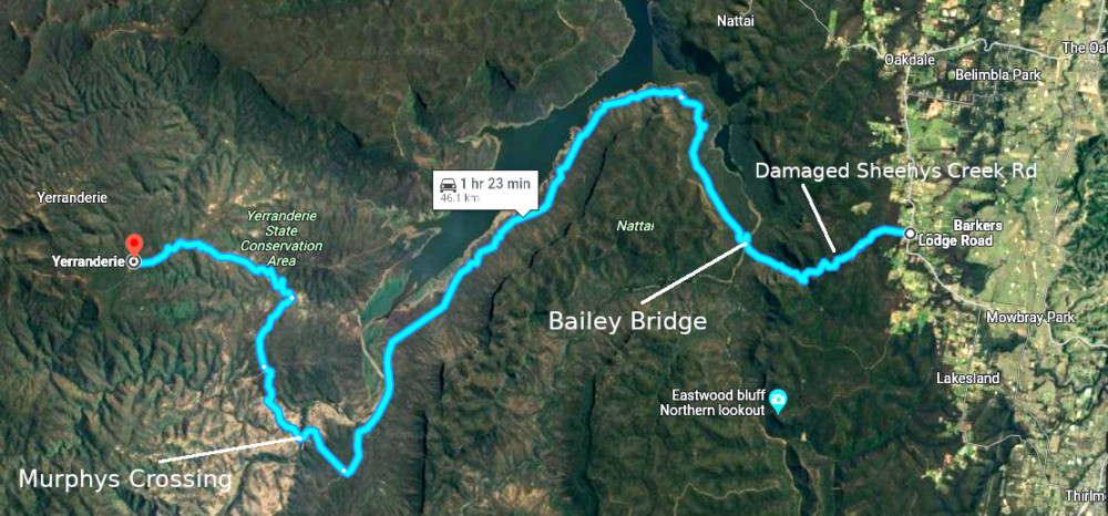
It is no longer possible to use this route as the The Sheehys Creek Road was washed out and now impassable. It is a big and expensive job to repair and may take a very long time.
Below is Michael Hamilton’s video of this way in when the Water Board was allowing periodic escorted trips.
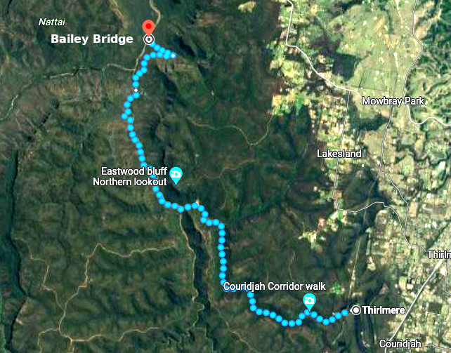
2- Thirlmere Lakes via the W4i then the W4 Trails
There has been investigations as to the viability of bypassing the damaged Sheehy’s Creek Road section by going from Thirlmere Lakes via the W4i Trail to the Bailey Bridge then the same route afterwards. We will report when we have news on how this option is progressing.
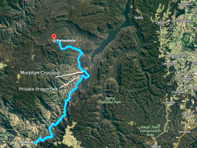
3- Bulio via the W4 Trail
There is a route to Murphys Crossing from Bulio along the Wollondilly River via the W4 Trail. After Murphys Crossing it would be the same route to Yerranderie. This mostly avoids the 3 kilometre Schedule 1 restricted land except for 2 short sections of road at Murphys crossing and where the Sheepwalk veers to the left and tracks up towards Yerranderie. Both these spots have traditionally been allowed to bushwalkers as corridors through the restricted land.
There are private property residences at “River Lodge” only 4.5 kilometres from Murphys Crossing. Obviously the owners are driving from Bulio along the W4 Trail.
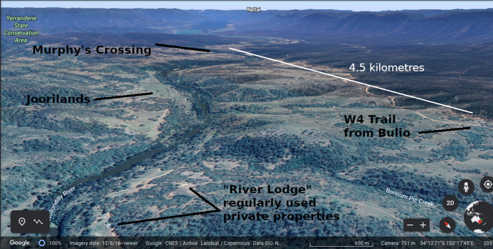
After Murphys Crossing and on the way to Yerranderie there is the Joorilands river and Byrnes Creek crossings to deal with but we understand that the crossings are undergoing repair work. We expect that this work will be completed sometime soon.
We feel that this route from Bullio needs more research but could be an access route to and from Yerranderie. We regard it as particularly important to have another access route from the South. It may be useful in bushfire times for emergency services when other routes are not accessible.