The Wollondilly Council have proposed a world class, environmentally friendly walking route through our World Heritage area. We are excited about the prospect of eco-friendly tourism in our area and we believe this plan will attract the sort visitors who will embrace our heritage and environmental values!
Here are some useful links on the Great Burragorang Walk:
Wollondilly Council – ABC News Story – Wollondilly Advertiser News Article
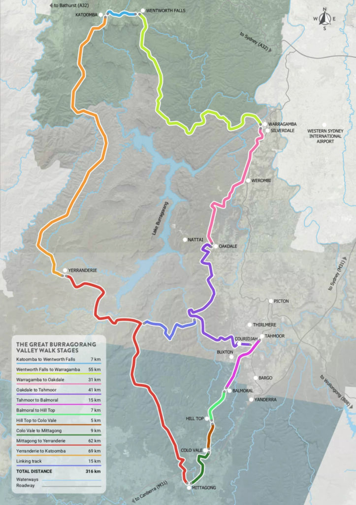
Proposed 3 day walk into Yerranderie via the Wollondilly River Route….
PLEASE BE AWARE THAT THIS ROUTE IS FOR DISCUSSION ONLY AS A POSSIBLE FUTURE SEGMENT OF THE GREAT BURRAGORANG WALK. MORE RESEARCH AND VARIOUS PERMISSIONS WILL BE REQUIRED TO BE NEGOTIATED.
Access to Yerranderie from the south via the Wollondilly River is very much easier than from the east via the Nattai River. We do not recommend walking to Yerranderie via the Nattai unless you are a very experienced remote area distance walker. We think this section may be difficult to incorporate into the Great Burragorang Walk.
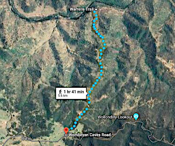
Our starting point for this alternate way is the Bullio Trig road which runs from the Wombeyan Caves Road just past Wollondilly Lookout. A stop at the lookout is an excellent opportunity to check out the walk ahead. A few kilometres further on your walk starts with an easy stroll down to the river.
The image below is from Google Earth above Wollondilly lookout. Click HERE to go to this spot and have a virtual “fly” around the area.
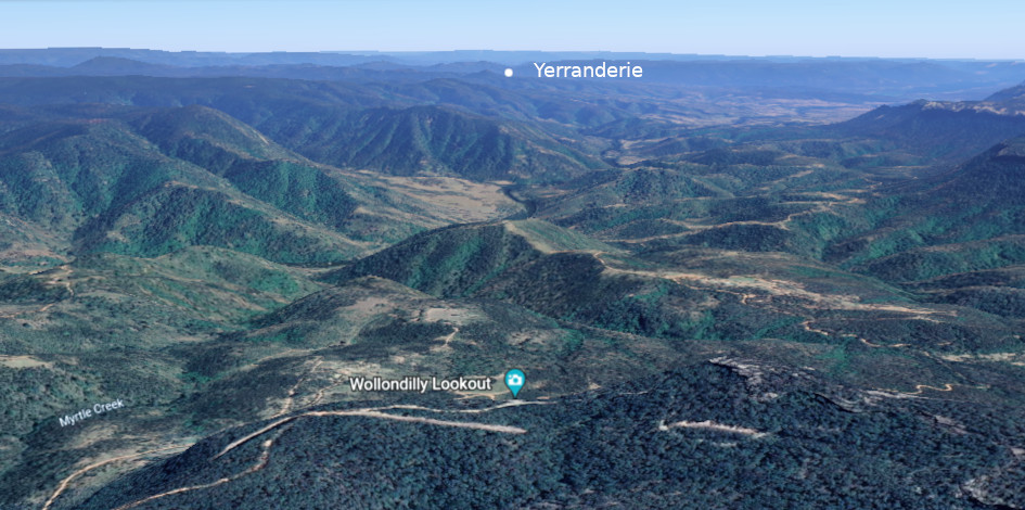
Day 1 is relatively short to allow time for you to travel from your home and commences with a stop at Wollondilly Lookout…. Then follow the Wombeyan Caves Road west until Bullio Trig and go down to the River. There are plenty of camping spots on the river for night 1 but please check your maps and make sure you are not camping on private land.
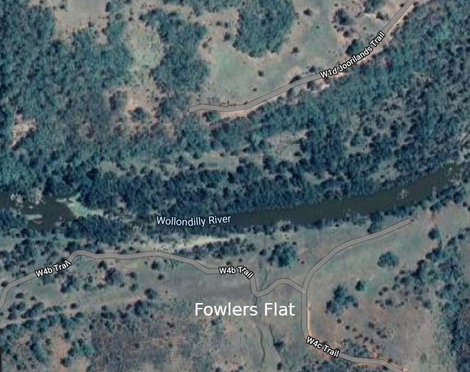
Day 2 is to follow the river downstream staying on the east side. Most of the river bank is on public land but there are some private blocks right on the edge of the river. Walking along the river in these sections will require the owners’ permission or walkers will have to walk further to the east on the trails. We will do some more research about walking along riverbanks where there is private property. This is the only day where you will not always be on existing trails. The river is in a wide valley and it is possible to leave the river to intercept farm trails nearby but walkers must check maps to make sure they are not cutting through private land. Go past the properties and there is a scrubby bit before an area called Fowlers Flat with a great view of Bonnum Pic. The river flows over rocky rapids here and there is a crossing over to the Jooriland farm road. 1 kilometre along this road and it becomes Schedule 1 Restricted Water Board Land. This is the 3 kilometre exclusion zone around Lake Burragorang. PLEASE DO NOT ENTER UNLESS YOU HAVE APPROPRIATE PERMISSIONS! YOU WILL FACE BIG FINES! We are hoping it will be possible to get a General Bushwalking Corridor permitted to transit through past Joorilands Homestead and onto the trails to Yerranderie as detailed below. Day 2 is not long and you can expect to be in on the W1d Jooriland Trail by mid afternoon, probably with lunch at Fowlers Flat.
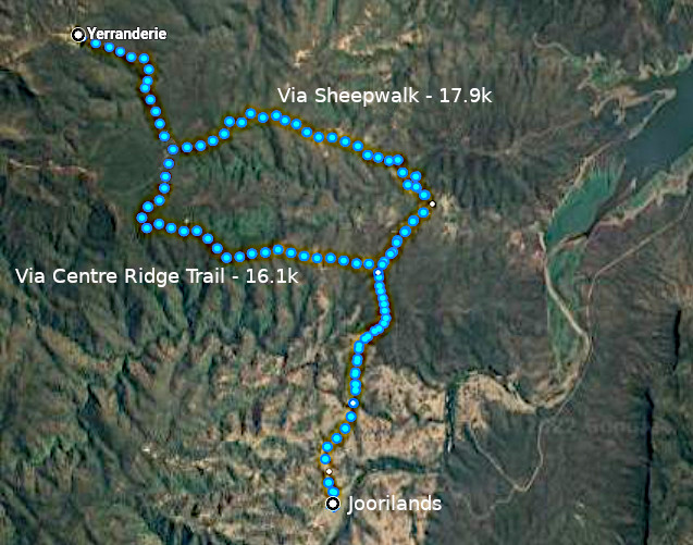
Day 3: What we are describing here only applies if permission is obtained to transit Schedule 1 Restricted Land at Joorilands. The bushwalking groups may be able to apply for a permanently approved corridor.
As you leave Jooriland Homestead you take the road out and follow either the Sheepwalk or Centre Ridge Trail and then into Yerranderie via the Oberon Colong Stock Route. This is the hardest day as there is quite a bit of uphill. The Centre Ridge Trail keeps you just outside of Schedule 1 land and is also an easier walk with mostly a gradual climb. The Sheepwalk has more ups and downs. It dips into Schedule one land but in the past there has been an official bush walking corridor.
When you get to Yerranderie: Finishing in Yerranderie you can book into some comfortable accommodation. Yerranderie has an airstrip and we are in the process of discussing aircraft and helicopter access to pick up bushwalkers and fly you back to south western Sydney with a spectacular scenic flight over the Burragorang.
For the intrepid walkers there is the option to continue on to Katoomba. More to come about that option. Stay tuned!